


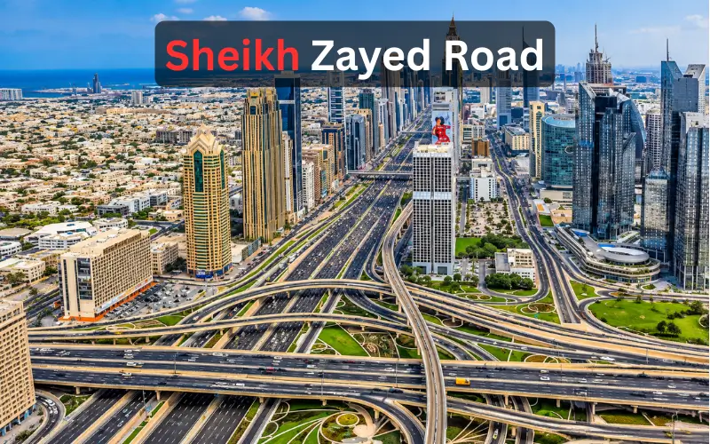
Sheikh Zayed Road is the primary road in Dubai and part of the UAE main inter-emirate road, E11. It links some of the key business, residential, shopping and entertainment hubs in Dubai. The road passes the Dubai World Trade Centre, Emirates Towers, Museum of the Future, Burj Khalifa and Mall of the Emirates. It also has access to the Dubai Metro Red Line and many of the major places are easily accessible without the use of a car. It has an extensive system of major interchanges that connect to the city’s central neighbourhoods and further south. It is one of the most significant roads for Dubai travellers and drivers.
Quick Facts About Sheikh Zayed Road
| Detail | Information |
| Highway number | E11 |
| Emirate | Dubai |
| Wider UAE route | E11 |
| Dubai Metro | Red Line |
| Major districts nearby | Trade Centre, DIFC, Downtown Dubai, Business Bay, Al Barsha, Dubai Marina, Jebel Ali |
| Major landmarks | Emirates Towers, Museum of the Future, Burj Khalifa, Dubai World Trade Centre |
| Major shopping destination | Mall of the Emirates |
| Road toll system | Salik |
| Main transport authority | Dubai Roads and Transport Authority (RTA) |
| Road character | Highway and major urban commercial corridor |
It is the name of the Dubai stretch of the E11 highway. The Dubai section of this highway is known as Sheikh Zayed Road and the UAE government states that E11 stretches across the UAE.
What Is Sheikh Zayed Road?
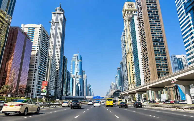
Sheikh Zayed Road is the Dubai section of E11, one of the UAE principal inter-emirate highways. According to the UAE government, E11 is the longest road in the UAE, which is called Al Silah in Abu Dhabi and the boundary of Ras Al Khaimah.
The highway is synonymous with the modern skyline of Dubai when it comes to the city’s interior. The highway is deeply connected to the modern skyline of Dubai in the interior of the city. The corridor traverses key commercial and residential hubs and links to Downtown Dubai, Business Bay, Trade Centre, Al Barsha, Dubai Marina and other parts south to Jebel Ali.
It can thus have two meanings, depending on the context. In transport information, it is the Dubai part of E11; in property listings, hotels and neighbourhood guides, it could be more specifically the Dubai high-rise-lined corridor running through the centre of Dubai.
Where Does E11 Run in Dubai?
E11 is not a standalone neighborhood, but a part of the Dubai urban districts. It traverses the World Trade Centre, Emirates Towers, Financial Centre, Downtown Dubai and Business Bay and then heads to Al Barsha, Dubai Internet City, Dubai Marina and Jebel Ali in the centre of Dubai.
This is the reason why the highway is crucial for local and inter-emirate travel. The road network extends from central Dubai to the major commercial areas and residential communities and destinations further south.
It is also connected to other major Dubai highways. Visit Dubai, for instance, mentions that Jumeirah Lakes Towers is located next to E11 and is connected to D61 and D59 and E311 and E44 offer other connectivity around the area.
Dubai Metro Stations Along the Corridor
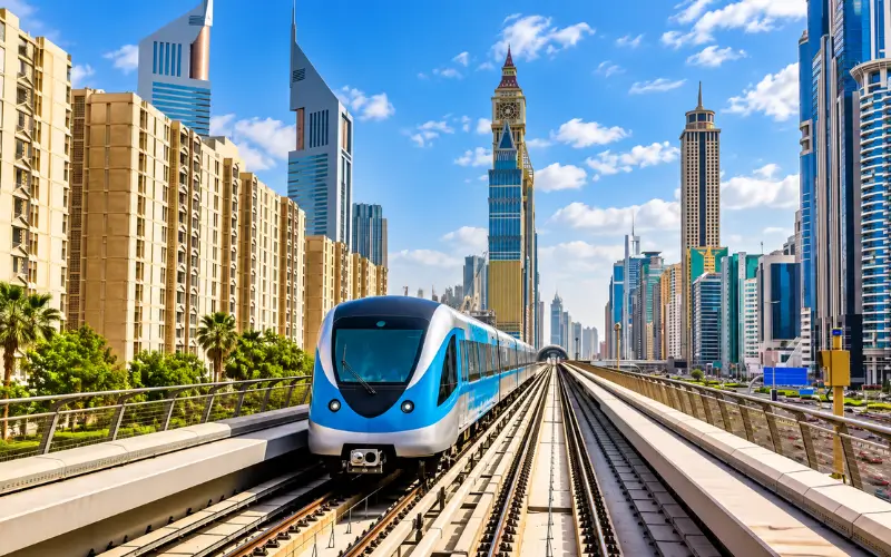
The link with the Dubai Metro Red Line is one of the largest practical benefits of the E11 corridor. According to RTA, the Red Line will connect to Expo 2020/Life Pharmacy and will be parallel to the highway for most of its route all the way to Centrepoint.
Several good RTA stations are located on or off this corridor:
- World Trade Centre
- Emirates Towers
- Financial Centre
- Burj Khalifa/Dubai Mall
- Business Bay
- ONPASSIVE
- Equiti
- Mall of the Emirates
- Dubai Internet City
- Sobha Realty
- DMCC
On RTA’s latest metro map, these stations are marked as Red Line stops and that’s the best reference for them compared to the older metro maps that are accessible online and might refer to the old names of these stations.
The corridor is especially convenient for tourists as several key points can be reached without a car. This is the case with the Red Line station at Mall of the Emirates, which has an enclosed walkway that links directly to the shopping centre.
Which Metro Station Should You Use?
The quality of the station is determined by the road, not the destination.
World Trade Centre station is the station for Dubai World Trade Centre and One Central. Emirates Towers is connected to the nearby Emirates District and Burj Khalifa/Dubai Mall is connected to Downtown.
At Mall of the Emirates, the station of the same name is directly connected to the mall. The current RTA network information is also included in the station sequence and line connections, making it the right one to use when checking routes before travelling.
Major Landmarks and Attractions Nearby
Some of Dubai’s most renowned commercial, cultural and architectural landmarks are located around the E11 corridor.
Museum of the Future
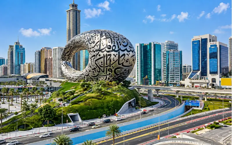
Museum of the Future is located next door to the Trade Centre district and is one of the most recognizable buildings on the walk. Visit Dubai calls it on Sheikh Zayed Road in Trade Centre and defines the museum as an immersive experience dedicated to what might be. Visit Dubai says it’s located on Sheikh Zayed Road, Trade Centre and describes the museum as an experience dedicated to what could be with technology and innovation.
It’s also easily accessible for visitors around World Trade Centre, Emirates Towers and Downtown Dubai.
Emirates Towers
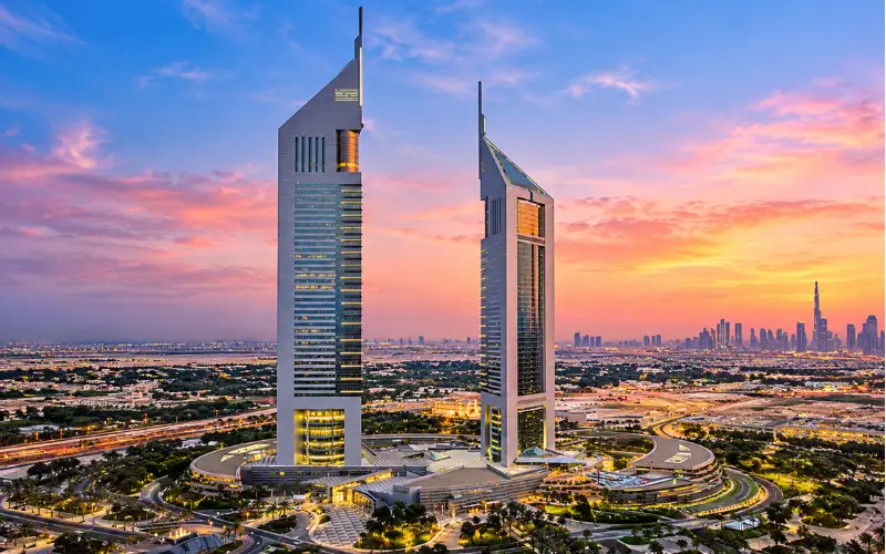
Emirates Towers is one of the iconic landmark buildings of Dubai’s business district. The towers are located in the center of a commercial corridor and are near the Museum of the Future, DIFC and the World Trade Centre district.
Its surrounding area features offices, hotels, restaurants and pedestrian facilities that are very relevant to business travellers.
Burj Khalifa and Dubai Mall
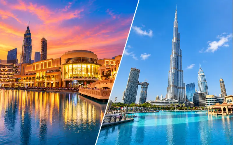
Burj Khalifa and Dubai Mall are not on the carriageway, but the Downtown district is close to E11. The Burj Khalifa/Dubai Mall Metro station is located on the highway and routes to the Downtown area.
It is important when planning a trip because the highway is the primary road that connects to the metro station and connecting roads that go into Downtown.
Dubai World Trade Centre
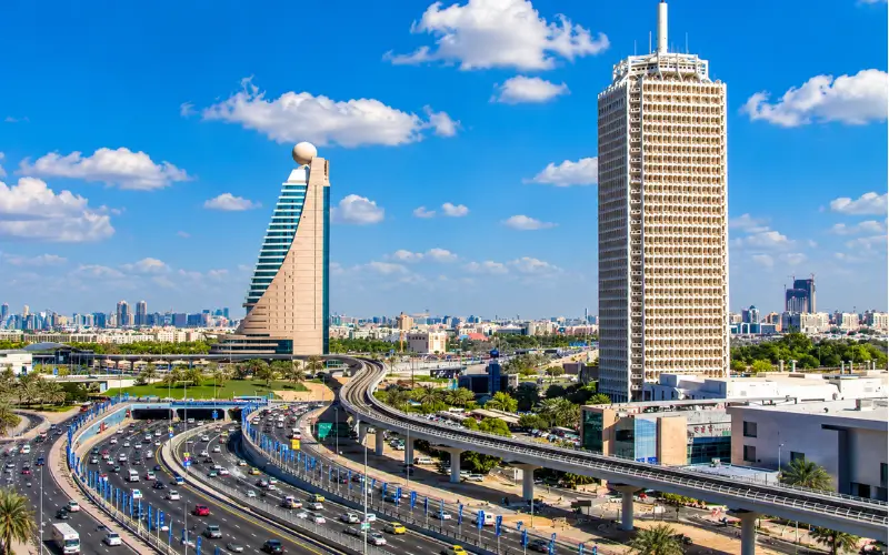
Dubai World Trade Centre (DWTC) is strategically positioned in the Trade Centre district. The nearby One Central development is home to hotels, restaurants, entertainment and business facilities and the World Trade Centre Metro station has direct rail connections.
This is especially convenient during exhibitions and conferences, as visitors can get to the exhibition from the metro and stay in hotels or offices in the vicinity.
Shopping Destinations Around E11
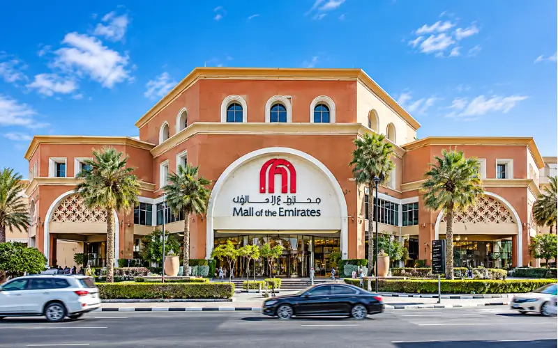
The corridor runs through several of the major shopping districts.
However, Mall of the Emirates is one of the most accessible, with a highway route and a Red Line metro station. Visit Dubai says it is Interchange 4 and the mall states that there is a direct metro connection via the enclosed walkway.
Other shopping areas have been spread throughout the corridor. The surrounding road network offers alternate connectivity to Oasis Mall, Dubai Marina Mall and Ibn Battuta Mall in either direction. These places should not all be directly adjacent to one stretch of highway, but rather, they are corridor places that are nearby.
Business Districts Along the Route
The commercial value of the road is due to its proximity to some of Dubai’s main business areas.
The middle part connects to Trade Centre, DIFC, Downtown Dubai and Business Bay, forming one long commercial area comprising offices, hotels, restaurants and tall residential buildings. The Dubai Media City corridor is defined by Cushman & Wakefield Core as a large business district comprising office towers and the Dubai Media City access to Dubai World Trade Centre, Dubai International Financial Centre and surrounding commercial facilities.
Further south, E11 leads to the areas of Dubai Internet City, Dubai Marina and Jebel Ali. This has resulted in the current RTA metro map, which has included Dubai Internet City, DMCC and Sobha Realty as stations.
Geographic clustering of employment is one factor contributing to high commuter traffic along this route, especially at central interchanges and business areas.
Driving, Salik and Traffic
It is important for drivers to be aware of the possibility of Salik, Dubai’s electronic road toll system, being in effect throughout the main highway network. Salik is a free flowing tolling system with a tolling system using vehicle identification technology and toll gates located on major corridors such as E11 and Al Khail Road.
The UAE government currently claims that AED 4 is being charged by Dubai when vehicles pass through a Salik toll gate. Conditions of the charges and operating arrangements may alter and drivers must check the rules in force before travelling by Salik – please check with Salik before travelling.
The amount and nature of traffic changes with time, direction and location. The RTA has been working to further increase the capacity of the corridor, with a two km stretch between Burj Khalifa/Dubai Mall Metro Station being widened in August 2026 from six to seven lanes and engineered to enhance peak hour travel time.
Is Metro Better Than Driving?
No one solution fits all trips. The metro eliminates the need for road traffic and parking, whereas a car offers more flexibility if the destination is not located at a station.
The Red Line will be particularly convenient if you are traveling around World Trade Centre, Emirates Towers, Downtown Dubai, Business Bay, Mall of the Emirates or Dubai Internet City, as stations are located along the main corridor.
Consider using a car or taxi for multiple road trips or when carrying luggage or travelling as a group where multiple road connections are required.
Living Along the E11 Corridor
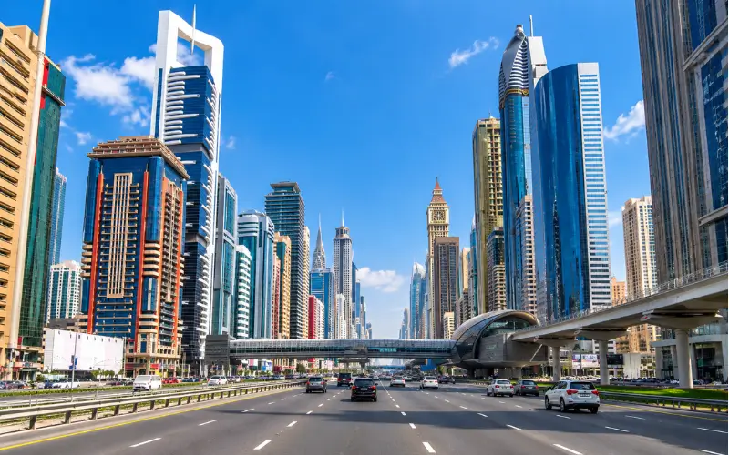
Residential development along the highway is not a traditional low-rise neighbourhood but high-rise apartment towers and mixed-use development. The central corridor is referred to as a mix of offices, hotels and residential towers and retail, services and the like are frequently part of or integrated within the buildings.
The primary benefit is the connectivity. Business districts, shopping centres, restaurants and metro stations are located within a short distance from residents and although the city is busier than quiet residential areas off the highway, its overall level of congestion is not that high.
Even the parking areas can be very different from one building to another. Before renting or buying a property, the parking provision on the property should be assessed, not taking it for granted that there will be public parking nearby.
Hotels Along Sheikh Zayed Road
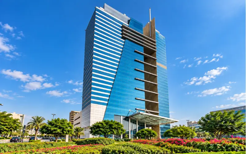
The hotels are located in the central areas of the corridor, with the Trade Centre and Emirates Towers in particular, which cater to business travellers, visitors to the exhibition and tourists.
These include The H Dubai, Four Points by Sheraton Sheikh Zayed Road, Towers Rotana, Crowne Plaza Dubai and Millennium Plaza Downtown. These are among the established hotel properties around the corridor which are listed in property and hospitality guides.
The hotel selection must be based on the destination. For those attending an event at DWTC, it’s advisable to stay close to World Trade Centre, whereas a leisure traveller may prefer to be closer to Downtown or Mall of the Emirates.
How to Reach Popular Dubai Destinations
The highway is best viewed as a transportation spine and not as a single point of entry for the city.
For Mall of the Emirates, drivers can use E11 and Interchange 4, while metro users can travel directly to Mall of the Emirates station.
Al Barsha refers to Visit Dubai junctions from E11 that lead to various areas of Al Barsha such as Al Barsha Pond Park and Barsha Heights.
The district is located adjacent to E11 and connects with D61 and D59 at Jumeirah Lakes Towers. The stations in the metro network are also linked to the rest of the rail system and the Dubai Tram.
E11 links Bur Dubai to the central road network from the Garhoud Bridge area to the Trade Centre Roundabout.
Best Way to Navigate the Road
The best way to do this is to enter the address of the destination you are going to, instead of just typing in a highway name.
Before travelling:
- Make sure you are heading to the correct exit or interchange.
- If public transport is available, check out the current RTA metro map for the route.
- Discuss Salik implications when driving.
- Give extra time around the Trade Centre and around Downtown during busy times and significant occasions.
- Make sure you have arranged for parking at the end of the journey before traveling.
RTA offers up-to-date maps and timetables of the metro system and Salik offers details on its toll system. When verifying travel information that may change, these official documents are better than older “third-party” guides.
Why the E11 Corridor Matters to Dubai
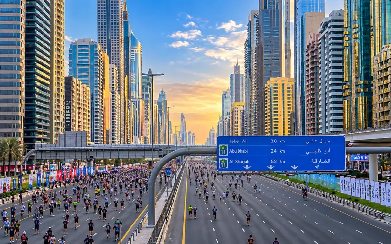
This highway is important not just for transportation to and from work. The alignment links to some of Dubai’s most important economic and tourism districts and the parallel metro system provides an alternative to road transport for travellers.
The corridor is also a key component of Dubai’s transportation system, as evidenced by recent investments by the RTA. The planned widening of the road near Burj Khalifa/Dubai Mall Metro Station was primarily designed to enhance the road layout and connectivity in one of the busiest areas of the city.
The obvious benefit for visitors is that there is a single transport corridor to reach many key tourist destinations by car, taxi, or metro.
Conclusion
Sheikh Zayed Road continues to be one of Dubai’s most vital transport corridors and continues to connect some of the city’s most key business districts, residential areas, shopping hot spots and tourist attractions. It connects the Dubai area of E11 as well as other emirates. Dubai Metro Red Line is another great way to get around without the use of a car. Key attractions along the way are World Trade Centre, Emirates Towers, Downtown Dubai, Mall of the Emirates and Dubai Marina. When travelling, drivers should take Salik tolls and traffic and parking into account. It’s well connected to the road and metro networks, making it a key hub for transportation around Dubai.
Must Read: Mohamed Bin Zayed City: Location, Living, Schools, Transport and Amenities
Al Hudaiba Awards Building: Location, Offices, Transport & Complete Guide
Frequently Asked Questions
Is E11 the same road as Sheikh Zayed Road?
Yes. The highway number is E11 and the Dubai part of the highway is known as Sheikh Zayed Road.
Which metro line runs beside E11 in Dubai?
Much of E11 runs parallel to the Dubai Metro Red Line.
Which attractions are near Sheikh Zayed Road?
The prominent places are Museum of the Future, Emirates Towers, Dubai World Trade Centre, Burj Khalifa, Dubai Mall and Mall of the Emirates.
Is Mall of the Emirates directly accessible by metro?
Yes. This is the Mall of the Emirates Metro Station, which has direct access to the mall.
Does driving on E11 involve Salik?
Yes. Salik toll gates are in place on E11 in Dubai.
Is E11 suitable for tourists?
Yes. E11 links to Dubai’s top hotels, attractions, shopping centres and business districts.
Which areas are connected by the road?
It links to or leads to the Trade Centre, DIFC, Downtown Dubai, Business Bay, Al Barsha, Dubai Internet City, Dubai Marina and Jebel Ali.
Is parking available near the highway?
Yes. Depending on the destination, many malls, hotels, offices and residential buildings have parking.
What is the best way to travel during busy periods?
Taxis or cars may work for areas that are further away from the metro, but the Metro Red Line can be convenient for places close to the stations.
Does the road connect Dubai with Abu Dhabi?
Yes. Sheikh Zayed Road is part of the E11 road, from Dubai to Abu Dhabi and other emirates.
